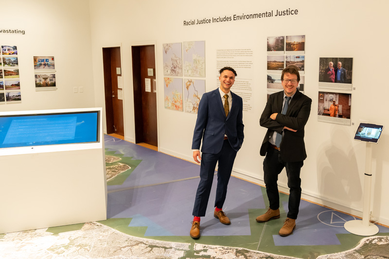
Above: Brandon Davis '22 and Dr. Johnny Finn stand amongst the multi-media exhibition 'Living Apart: Geography of Segregation in the 21st Century'
Read time:
Dr. Johnny Finn, associate professor of Geography and chair of the Department of Sociology, Social Work and Anthropology, has created a unique and innovative exhibition that depicts both the historical and modern-day impact of racist housing policies. Finn’s multi-media exhibition, showcased in the Fleming Gallery at the Virginia Museum of Contemporary Art (MOCA), is entitled Living Apart: Geography of Segregation in the 21st Century. The exhibition is the culmination of the five years of research Finn conducted, with the assistance of undergraduate students, on the lingering impact of a century of discriminatory housing policies. It explores the present-day socio-economic, environmental, and health impacts of the long history of racist housing practices in the United States using experimental photography, cartography, text, documentary film and interactive maps.
“Working with a team of undergraduate research assistants, we conducted over 100 interviews,” said Finn. “We distributed cameras to dozens of participants to photograph places that are meaningful to them in some way, and compiled data from the Census Bureau, the Environmental Protection Agency, the Centers for Disease Control and Prevention, and many other sources to map out the systemic nature of urban racial inequality in the United States, focusing especially on Hampton Roads.”
Visitors immediately get a sense of that inequality when they enter the gallery. A massive floor map of Hampton Roads covers nearly the entire room. The aerial photography is detailed enough that local residents can kneel down and pick out their house. That map, along with historical documents, participant-directed photography, oral histories and archival documents help tell the story of the history of segregationist housing policies and their lasting impacts in the present day.
“This 650-square-foot map uses extremely high-resolution aerial photography to show the entire Hampton Road region. The idea is to allow visitors to put themselves on the map—literally and figuratively—and to think about where, and how, they fit into this broader story,” said Finn. “Then, on the surrounding walls we use historical archival documents, maps, photographs, and text to show the devastating and long-term impacts—from the scale of the individual body to the entire city—of our legacy of racial segregation. In the middle of the gallery, there is a 55” touch screen display with an interactive map of the entire U.S. that enables visitors to explore how discriminatory housing policies played out in urban areas across the entire country.”
During the Great Depression, race played a role in determining the rating neighborhoods would receive by government surveyors. Black neighborhoods were often marked on the maps in red, beginning the discriminatory process now known as redlining. Redlining often resulted in concentrated poverty.
Finn’s exhibition concludes with a section entitled “Where do we go from here?”, which highlights both policies that cities and municipalities across the country are experimenting with, along with actions individuals can take to play a role in building a more racially, environmentally, and socially just future for everyone.
Finn has also organized a series of teacher workshops for K – 12 educators in conjunction with the exhibition. More info and registration details for those workshops can be found here.