Christopher Newport University is 5,620 miles from Turkey.
But that huge distance did not prevent Christopher Newport students from lending a virtual hand to the rescue efforts underway in the aftermath of the devastating 7.8-magnitude earthquake that struck Turkey and Syria on Feb. 6, killing more than 41,000 people and destroying at least 6,000 buildings.
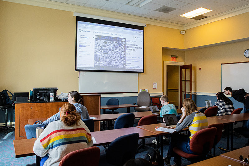
The students provided help without leaving campus. In fact, they never even left campus. They were able to offer critical assistance from their seats in Assistant Professor Federica Bono’s Human Geography 2 class in Trible Library. With the assistance of technology, the students mapped areas hardest hit by the disastrous quake.
Using a platform that accesses satellite images of what the area looked like before the earthquake, students focused on a particular geographic area and digitally traced buildings, homes and roads. They then went to the OpenStreetMap site and populated the maps with the digitized images so humanitarian aid workers and organizations can visualize the areas where relief efforts are most needed.. Being part of the mapping project provided an opportunity for students to make a positive impact by producing a blueprint of the lay of the land for people on the ground so help can be delivered to earthquake-ravaged regions as quickly and concisely as possible.
For Tyler Bell, ’23 business management, the mapping experience gave him “real world experience.
“Applying what we’re doing in class and making a difference is really great,” he said. “It’s definitely nice to be able to make a contribution.”
Many of the affected areas in Turkey and Syria have not been officially mapped in the past. That puts aid workers at a disadvantage both in terms of response times and allocation of resources. The more accurate the maps are, the more effective relief teams can be with their aid. That means they can reach more people quickly and work to mitigate the disastrous circumstances they face in the wake of the earthquake.
“It helps them to estimate how many families are homeless by the number of buildings they see on the map,” said Bono, assistant professor in the Department of Sociology, Social Work and Anthropology. “It helps narrow down their field assessment and prioritize areas where there are a lot of people in need.”
To make a difference in the world, all it took was a laptop and simple direction. And the help doesn’t have to end when the students step out of Bono’s classroom. Mapping is something they can do as often as they want from home.
Students were surprised at the ease of the mapping and excited to be part of the humanitarian efforts.
“I really enjoy it. I think I will be doing more of it. I like knowing I can help from thousands of miles away,” said Ella Huck, ’26 psychology. “I think it’s very cool to help communities outside of your own community.”
The mapping is “a pretty simple task,” said Andrew Bryant, ’27, “But it makes a large impact.”
Bono said she has done mapping at Christopher Newport before, but usually in the realm of a mapathon, which is when people hone in on populating maps during a designated window of time, but is not tied to any real-time disasters.
Mapping is often used to help with vaccination campaigns, medical supply distribution, infectious disease prevention and other humanitarian efforts in hard-to-reach areas all over the globe. Bono says she intends to utilize mapping more extensively in her classes not only to assist with immediate disasters, but also to document areas of the world that are not extensively mapped.
“More vulnerable areas tend to be less mapped,” Bono said.
OpenStreetMap is the equivalent of Wikipedia for maps, with the crowdsourcing element being the engine that helps populate many of the world’s often-blank maps. The platform has created an opportunity for people worldwide to contribute to the relief efforts without leaving their classrooms, offices or homes.
“It allows people like us, who are far away from a disaster or vulnerable area, to be able to help,” Bono said.